Friday, December 29, 2006
Google Earth
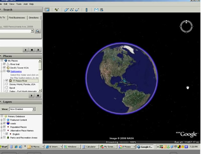
Jim did his Google Earth seminar yesterday and I'm starting to understand it enough to get hooked! Someone today came up and asked if you could use Google Earth to look at a river and see if it would be a good area to paddle. You know, no dams, no waterfalls, stuff like that.
What a good idea!
We are planning to paddle the Peace River this Sunday (our good friend, Marie, is coming to visit) and we want to do a little more distance than the last time.
Here is a video recording - a 'screencast' - of me using Google Earth to decide exactly where to paddle on the Peace River.
Wednesday, December 13, 2006
Namibia Video
Yeehaw!! I did it! I took 5 hours of Mom's video and created a 6.5 minute 'highlights' video. Or .. to hear Mom tell it I *cut out* 293 mintues of essential stuff! "But you gotta show the termite hills, and the night shot of the rhinoceros at the watering hole, and the villagers inside the smoky hut, and the waves breaking on the pier ... and ... and ..."
Anyway - here it is. If you have a slow connection, you may want to click on the pause button (2 vertical bars) until it downloads sufficiently (the first time you'll need to click twice). You can see the download progress on the dark gray bar. Then you can click on play again.

Click here for a highlights Video of the trip. (6.5 minutes)
Pretty cool huh?
p.s. we're back at home in Peace River now.
Anyway - here it is. If you have a slow connection, you may want to click on the pause button (2 vertical bars) until it downloads sufficiently (the first time you'll need to click twice). You can see the download progress on the dark gray bar. Then you can click on play again.
Click here for a highlights Video of the trip. (6.5 minutes)
Pretty cool huh?
p.s. we're back at home in Peace River now.
Labels: videos
links
2 computer geeks and one perfect poodle, live and travel in their RV making a living with computer skills. Computer Education for RVers, Internet Satellite Installations, Wi-Fi help, Website design.
Previous Posts
- Google Earth
- Blog Migration Successful!
- Blogger migration
- Water in the River
- Christmas Day
- It's a Wonderful Life
- Sittin' on the Bench of the Bank
- The Park is filling up
- Solomons Castle
- Visitors
Archive
My links
- Blog Index
- Site Feed
- Map of where we are now
- "Geeks on Tour" Our Business Website
- Our Web-based Photo Albums
- Mom's Blog
- Other RVers
- Diane and Andy's Blog
- Tioga and George
- Brightwing RV
- Lynne and John
- Cliff and Marie
- Hitch Itch: RV Travel Adventures and Journals
- Gypsy John
- Anne and Norm (fellow divers now discovering RVing!)
![]()